The clouds started to become more numerous as we headed further up the River Hull towards Driffield. It started getting a bit cool when the sun was hidden. We had passed the half way mark in the last blog.


 It was then our turn whilst the 'Sun' was turning round to take our empty lock. Here we are winding the gate paddles on the bottom gates. These are just about normal and you can use a normal windlass and push the beam to open them. However the top gates are another kettle of fish, and require a very different windlass for the gate paddle it has a square section of about 2" and the spindle comes up through the middle. The one for the mechanism to open the gate is also a bit different. Very kindly we have been lent them by the Beverley Barge Preservation (BBPS) guys.


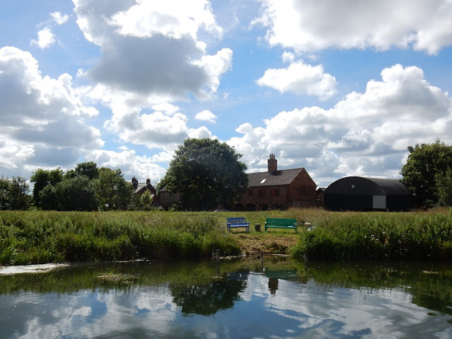
We were now passing Linley Hill farm that looked as though it had become a private residence as the barn conversion looked lovely. and I could spend hours sitting on those seats watching the river pass by. Just a little further down the road leading to the 'farm' is the grass airstrip of Hull Aero Club. This is of interest to me as the club started in 1930 at the airport near where I live that had been a race course then in 1930 it became Hull Aero club's base and in that year it was where Amy Johnson flew into to claim the Freedom of the City of Hull following her pioneer flight to Australia in her Gypsy Moth plane 'Jason'. The original is in the Science Museum in London but hanging from the roof of Hull's Paragon Station is a replica built by prisoners of HMP Hull, and it is tiny.

We now arrive at Wilfholme Landing where there are these moorings, many of which have little chalets on stilts attached. Technically it seems that the Driffield Navigation Navigation starts just south of here where the Aike Beck joins the River Hull. The 'Sun' was starting to get a bit of weed trouble around the plot, but she is a lot deeper than us. We could see the weed as the water was still gin clear but we were well clear of it. At the landing is a pumping station that can pump 161 million gallons of water a day from the Beverley and Barmston Drain that runs very close to the river. Apparently it is unable to pump water into the river when the river levels are high and as such will not be funded by the Government. It costs £80,000 per year to run and they were just going to close it despite the certainty of moor land become waterlogged and higher risk of flooding. The plan was shelved until 2013 but not sure how it was resolved.

Both John and Chris had a steer of the boat, and did very well keeping us out of the deep weed and lilies near the sides. Both commented on the amount of concentration that was required.

We passed Tophill Low water works and Nature Reserve where there are 300 acres that have 160 species of birds. There is a new 10m long viewing gallery too. We then arrived at Struncheon Hill Lock. This is the limit of the tidal River Hull. The lock takes you up over the weir that can be seen on the right of the photograph. The sun is on the lock landing readying the lock and we are just waiting.
 It was then our turn whilst the 'Sun' was turning round to take our empty lock. Here we are winding the gate paddles on the bottom gates. These are just about normal and you can use a normal windlass and push the beam to open them. However the top gates are another kettle of fish, and require a very different windlass for the gate paddle it has a square section of about 2" and the spindle comes up through the middle. The one for the mechanism to open the gate is also a bit different. Very kindly we have been lent them by the Beverley Barge Preservation (BBPS) guys.
We have cleared the lock and the 'Sun'is taking our place to return to the Beck. as you can see there is a landing at top and bottom of the lock. It had taken us about 2.5 hours to arrive here and the HW here should have been around 1030 but the tide continued for some time after this. Speaking to Ian of the BBPS I was surprised to hear that there was plenty of water in the river, even after the dry period we have had. It seems that there is a bit of a blockage in the River down stream, near Ennerdale, probably encroaching mud banks and reeds, that limits the amount of water passing through so keeping levels high up river.

Above Strincheon Lock it seems that the navigation runs above the surrounding land. This must partly be because the land has shrunk once it has dried out with the drainage being in place. It means that the views are even better up this end of the waterway. Above the lock it is an artificial cut to get round the weir and then rejoins the River Hull .

The next obstacle is Bethell's Bridge, after the same family of Leven canal fame! There are many moorings along both banks here, but once again they have left no room for a narrow boat to land. Fortunately there was a vacant mooring that I just fitted in to land folk. You have to put cones out to stop cars when you are opening and the mechanism is an endless windlass with a wire that opens and closes depending on the way you turn it. The bridge keepers house had been for sale but seemed to be suffering a little subsidence, but had sold. A lovely spot and we had a bit of a chat to some of the local moorers too. Here we are just passing through

Up stream there is a little landing that you can see at the stern here. Despite it being a remote spot and the road being un-adopted we caused a two car and a tractor queue!

At Emmotland the river passes under a footbridge and passes to Corpslanding but the Navigation transfers to the Frodingham Beck. The land seems to fall even further below the canal and you can see meandering route of the canal astern by the line of the banks. You can also see the weed growing.

At Fisholme Junction the Frodingham Beck goes off to the right towards the North Frodingham Wharf and the navigation continues in a cut to the left to Snakeholme Lock. There are a further three locks to reach Driffield and I think all have been restored. The only stumbling block left to full navigation is a bridge a Wansford that was fitted with a fixed bridge and requires about £2 million to remove and replace with a movable one. The last cargo to Driffield was the keel 'Caroline' with 50 tons of wheat, and the last commercial cargo was 'Ousefleet' that brought coal to North Frodingham Wharf in 1951. We turned right.

We are getting close to our destination, the Wharf as this is the nearby Church. When I spoke to them at the Driffiled Navigation I was told that we should stop at North Frodingham Wharf as there was no winding hole for our length further on. From Fisholme Junction to the lock is about 2 miles, that is a longway to go astern. I also thought that this meant that there was a winding hole for the wharf. When we arrived it was clear there wasn't! Mind you it is only 3/4 mile back to the junction, which is much better than 2 miles.
No comments:
Post a Comment